The Country Club trail in Pinetop-Lakeside, Arizona, is a favorite hike in the White Mountain TRAX system. The 3.4-mile loop trail is great for all skill levels and is rated as easy. This is one of the best hiking trails in the Pinetop-Lakeside area. We consider it one of the best trails because of its proximity to town, and its reasonable length. Most hikers can finish this trail in about an hour. Horse riding and mountain biking are also allowed on the trail, so be aware of sharing the trail, especially in the summer months. During our hikes, we’ve seen smaller wildlife like birds and squirrels.
In this article:
Trail Details
Miles: 3.4
Time to hike: 1 hour
What makes the Country Club Trail such a great trail? Its diverse terrain. Starting from the trailhead going counter-clockwise, you begin in a ponderosa pine forest trail. Just after the Chipmunk Springs connector trail, you feel like you’ve entered a bit of a meadow. It’s common to see cattle grazing on the field grasses.
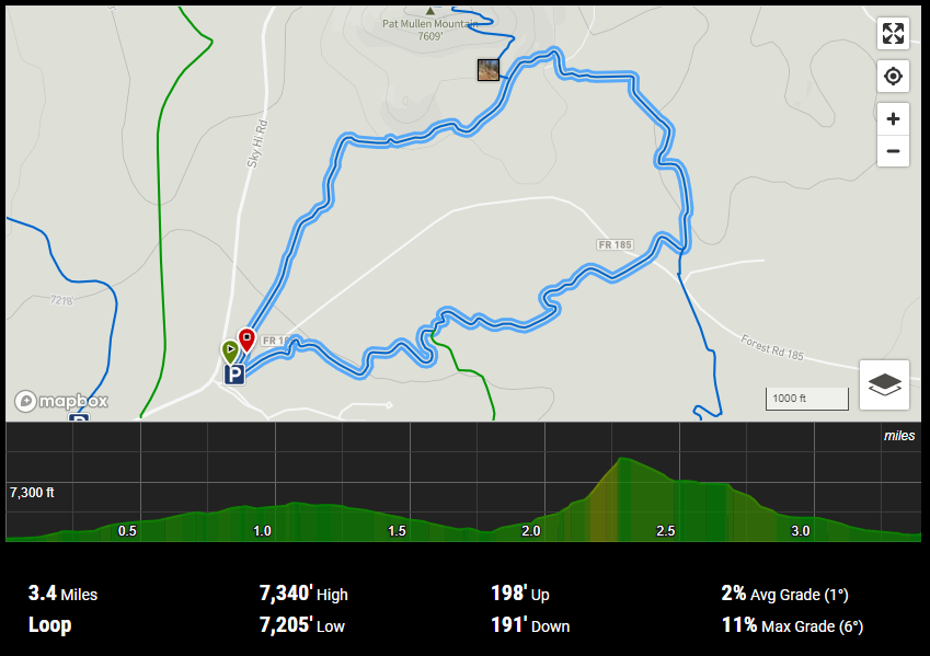
Trail map overview image from The Hiking Project:
Toughest section
As you pass through one of the forest service gates in the meadow at about 2 miles into your journey, you’re about to hit the most challenging part of the trail. At approximately two ¼ miles, you’ll run into the steepest ascent on the trail. I consider it a nice steady climb, and should get your blood pumping a little!
Then as you hiked up to and passed the Pat Mullen Mountain Spur trail, you start to feel like you’re descending a mountain trail.
Who can use the Country Club trail?
The trail is considered mixed-use and biking, hiking and horseback riding are encouraged.
Hikers – Yes!
Kids – Yes!
Horseback riding – Yes!
Mountain biking – Yes!
Pets – Yes! Dogs should be on a leash.

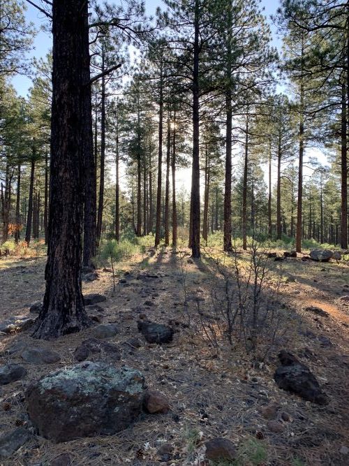
Sun starting to rise. Sun shining through the pines. 
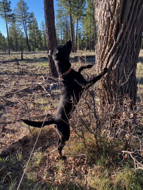
Tommy Boy squirrel hunting.
Recommendations
It’s a loop trail, which way should we go?
We’ve gone both directions but prefer to go counter-clockwise or right from the trailhead parking. Going this direction gives you the only decent climb in elevation about 2/3rds through the hike. It’s not that hard but should get your blood pumping.
When is the best time to hike the Country Club Trail?
The summer months are the busiest on the trails in Pinetop-Lakeside. This is due to the influx of visitors from the flatlands of Phoenix and Tucson. On a recent visit in May 2020, we hiked the Country Club Trail before 7 a.m. on weekdays and saw one other person each day we walked.
Is the Country Club Trail good for dogs?
Yes! Just keep your dog on a leash and have fun!
Will the Country Club Trail be good for my kids?
Yes, any child over the age of 6 or 7 will love this trail!
Getting There /Driving Directions
Directions to Pinetop, Arizona
Pinetop-Lakeside is located off Highway 260 in the White Mountains area of Eastern Arizona. Please use Google Maps for directions to Pinetop.
Directions to the Country Cluib Trail
Start here for Google Map directions.
From Arizona State Highway 260, turn to head east on Buck Springs Road.
Drive .6 miles and turn left on Sky Hi Retreat Rd (Forest Rd 182 / Tomahawk Rd).
Drive approximately 2 miles – note you will be passing the Springs Trailhead on the left-hand side of the road.
Turn right on Forest Rd 187, which is also the entrance to Sierra Springs.
As you turn in, the trailhead parking is ahead on the right.
Parking
There is ample parking at the trailhead.
[…] Country Club Trail #632 – Pinetop, AZ […]